
Mosquito Mange Camp. The informal community of sci-fi fans on Tuzla island, 1987. From the archives of T. F. Pridannikova, processed by Y. Y. Zubakin.
Nikolay Smirnov
The Island Imagination of Tamagne
Everyone has a beloved homeland,
Everyone has a longed-for place;
Burning with flame,
I seek Jerusalem,
My God-given land.
Mother Maria (Elizaveta Skobtsova), from the book Scythian Shards (1912)
The isolation of his country is a sign of the special path set out for him, and to disregard this sign seems rash.
Evgeny Vodolazkin, The Island Absolution (2020)
In this text, we will first point out the special features of island imagination, and then we will discuss why the image of the island can be considered key to understanding the specific features of Tamagne and its geographical imagination.
The Geopolitics of the Island
The island as an image that is different and separate from the external world of space often appears in utopias of various kinds and narratives of the end of the world. And yet, the utopian and eschatological types of imagination are interconnected and flow into one another, creating the basis for island imagination [1].
This complex of representations and the structures which give birth to it can be found in antiquity. In Sumero-Akkadian mythology, the island city-state Dilmun is referred to as the place where humankind was created and the cradle of civilisation. In Taoism, the Eight Immortals lived on an island in the Bohai Sea where everything was made of gold, and the fruits gave the gift of eternal life. The Ancient Greek philosopher Plato suggested that the health of the body politic depended on its geographical isolation. In his dialogue Crito, he described the perfectly organised state on the island of Atlantis. The philosopher noted that Poseidon surrounded the island with five rings and established a kingdom. However, the 'nature inherited from the god became impoverished', and Atlantis degraded. Even in antiquity, the idea of the creation of the earth and the end of the world was connected with the image of the island.
This complex of representations and the structures which give birth to it can be found in antiquity. In Sumero-Akkadian mythology, the island city-state Dilmun is referred to as the place where humankind was created and the cradle of civilisation. In Taoism, the Eight Immortals lived on an island in the Bohai Sea where everything was made of gold, and the fruits gave the gift of eternal life. The Ancient Greek philosopher Plato suggested that the health of the body politic depended on its geographical isolation. In his dialogue Crito, he described the perfectly organised state on the island of Atlantis. The philosopher noted that Poseidon surrounded the island with five rings and established a kingdom. However, the 'nature inherited from the god became impoverished', and Atlantis degraded. Even in antiquity, the idea of the creation of the earth and the end of the world was connected with the image of the island.
[1] On the dialectical connection between utopian and eschatological imagination, see: Nikolay Smirnov, "Gonkong kak apokalipsis", Moscow Art Magazine, 113, 2020. See also "Geo-fictions/Geo-stitions: Spatio-apocalyptic enquiries on the Eastern Edge of Eurasia", video. In brief, the beginning of the better world always leads to the end of the previous world. On this theme, see also: Gilles Deleuze, "Causes and Reasons of Desert Islands", Moscow Art Magazine, 90, 2013.
The island imagination developed markedly during the Renaissance. The islands depicted on portolan nautical charts and island atlases (such as Benedetto Bordone's Isolario, printed in Venice in 1528) are separate worlds; whole, hermetic and completely autonomous. They complement the continents like liminal spaces where the European social order can be overturned as, for example, on the island of Amazons, the island of cannibals or the island of plenty.[2] It is for this reason that the island imagination revealed on portolans and produced by them is connected, as Denis Cosgrove suggests, with the formation of the 'Oceanic Globe'[3] that forms the basis of the European imperial discourse. The researcher Antonis Balasopoulos defines this as the insular (from the Latin insula – island) institution of colonial modernity.[4] Furthermore, contemporary ideas of sovereign territorial states[5] as unique, equal and natural formations are based on Renaissance cartography. Islands were depicted in this way on portolan charts and, as a consequence, an aesthetic idea developed into a political concept.[6] The concept of 'sovereignty' and the autonomous subject is linked to insular thinking and Renaissance cartographic writing: the idea of the existence of autonomous objects, which is how islands existing in a 'sea' of dynamic interactions were perceived, gave rise to the idea of the autonomy of the state and the individual.[7]
[2] Denis Cosgrove, Apollo's Eye: A Cartographic Genealogy of the Earth in the Western Imagination (Baltimore: Johns Hopkins University Press, 2001), pp. 94–95.
[3] With 'Oceanic Globe' Cosgrove is referring to a specific regime of globalism, which formed in the 16th century after Columbus's voyages and is linked to the fact that maritime trade empires plated a dominating role in the world. It was islands rather than continental spaces that played a key role in the organisation of these empires.
[4] Colonial modernism means that the colonial project was inseparable from the foundation of the characteristic structures and regimes of the modern age (modernity), that is, modernity (the new age) was colonial by definition. For more detail, see: Antonis Balasopoulos, "Nesologies: Island Form and Postolonial Geopoetics", Postcolonial Studies, March 2008, p. 12.
[5] That is, states strongly linked to a particular territory. The formation of such states began in at the end of the Middle Ages, however they reached their apogee in the modern age, when they became the dominating and even exclusive type of state.
[6] P.E. Steinberg, "Insularity, Sovereignty and Statehood: The Representation of Islands on Portolan Charts and the Construction of the Territorial State", Geografiska Annaler, 87 B (4), 2005, p. 254.
[7] Tom Conley, The Self-Made Map: Cartographic Writing in Early Modern France (Minneapolis: University of Minnesota Press, 1996), p.6.
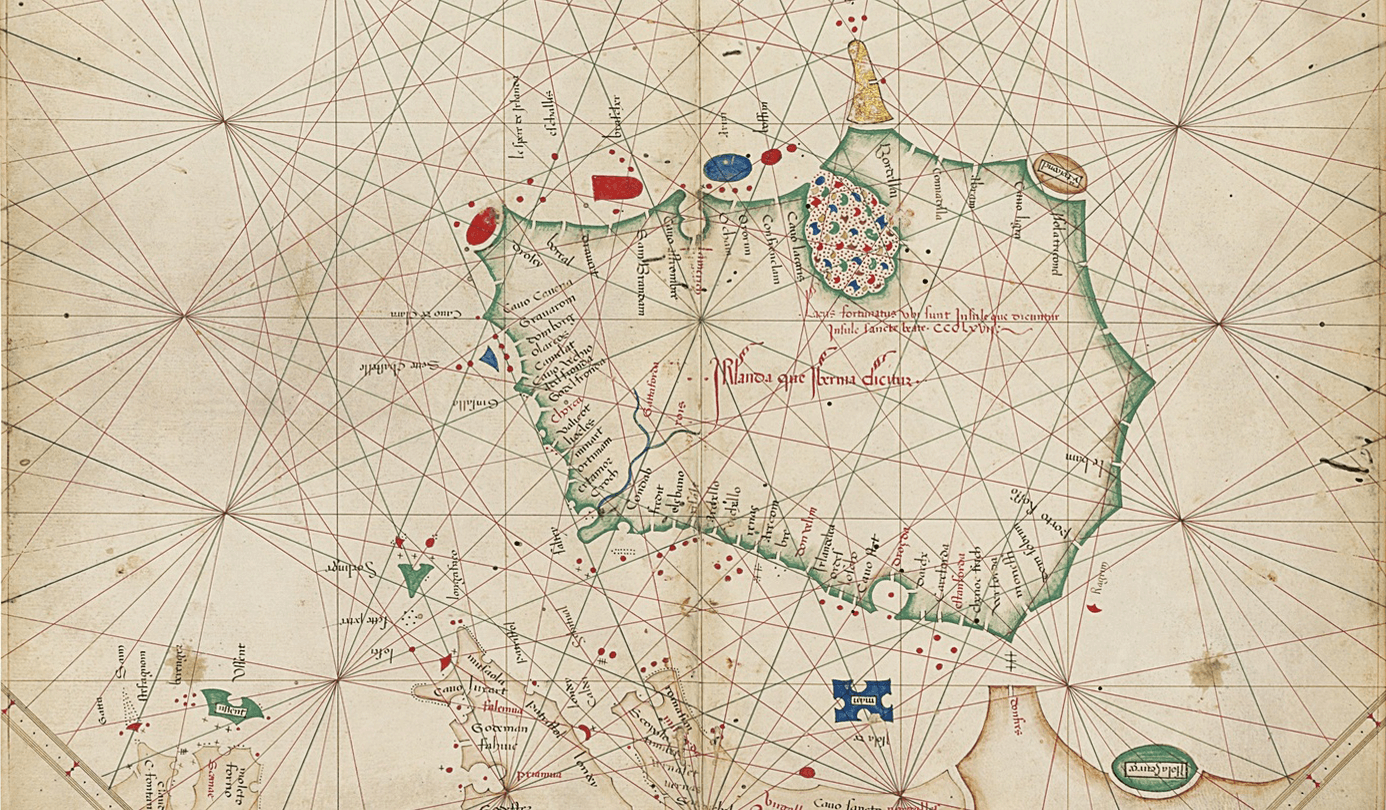
Map of Ireland from the portolan atlas by Grazioso Benincasa. Venice, 1468. Private collection, image c/o irishtimes.com.
All of these factors are revealed in the concept of utopia, which appeared in the modern age and was named after an imaginary island state described by Thomas More in 1516. More proposed searching for the ideal overseas and in this way influenced the formation of the European colonial project, for which the concept and genre of the utopia were later criticised.[8] Within them, the island represents both the quality of an ideal metropolis and that of an ideal colony, which is clearly shown in Daniel Defoe's novel Robinson Crusoe. The empire is born from an island-pupa, takes over other island-worlds and makes them in its image. This is the dialectic of island/empire.

Anonymous artist. Isola di Utopia (Utopia Island). Illustration (engraving) from the first edition of Utopia by Thomas More, 1516. Inscription: 'Utopiae Insulae Figura'
However, the neologism 'utopia' appeared as a result of the merging of two Greek words: οὐ-τόπος (ou-topia, meaning 'no-place' or 'place which doesn't exist') and εὖ-τόπος ('eu-topia', meaning 'good place'). This double meaning allows us to rehabilitate the concept of utopia, splitting it into two elements, the colonial and the anarchic. The first component, 'no-place', corresponds to the colonial search for new lands. The second, 'good place', transports us to the field of anarcho-geographical thought, where there is no ideal model that can be applied to newly discovered spaces. Conversely, we are dealing with concrete geographical reality, which it is necessary to improve based on local factors and the principles of humanism.[9] Examples of anarcho-geographical thought include the works of Peter Kropotkin, with their ideas of mutual assistance and the merging of city and village, the French geographer Élisée Reclus, the Italian anarchist Marie-Louise Berneri and the American sociologist Lewis Mumford, who considered the medieval commune to be the ideal civil structure, an example of cooperation and mutual aid. In the works of these thinkers, the idea of utopia was deconstructed and partially rehabilitated.
Having briefly described the island imagination of the modern age, we can now move on to the context of Tamagne.
Having briefly described the island imagination of the modern age, we can now move on to the context of Tamagne.
The Tamagne Archipelago
The natural features of Tamagne mean that the image of the island is key in understanding the specifics of its geographical imagination.
Tamagne is surrounded by the sea on three sides. Also, all of the lower Kuban and Tamagne, in particular, is a low-lying plain (the Kuban-Azov Lowland), divided by tributaries of the Kuban River and by reed beds and estuaries on a series of constantly changing land masses or 'islands'. The ancient writers Hecataeus of Miletus, Pseudo-Scymnus, Strabo and Pomponius Mela noted that Phanagoria (the Greek colony thought to have been located near the contemporary settlement of Sennaya) was located on an island. The most authoritative of them was Strabo.[10] Attempts to reconstruct the palaeogeography of Tamagne based on his works have led to the theory that in antiquity there was a series of islands here: Cimmerian Island (the contemporary Fontalovsky Peninsula), the island of Phanagoria (Sennaya settlement ), Tirambeisky Island (from Peresypsky river mouth to the settlement of Golubitskaya), Sindica Island (south-west Tamagne), Kandaursky Island (the Temryuk-Kurchansky ridge) and Blagoveshchensky Island (Blagoveshchensky ridge, between Kiziltashsky and Vityazevsky estuaries).[11] The islands were divided by tributaries of the Prakuban River, known as Antikit and Gipanis. This model emerged in the 19th century and prevailed throughout the 20th. Soviet geographers, in particular, wrote that 'in ancient times, long before the arrival of the Greeks, the contemporary Tamagne peninsula was an archipelago'.[12]
Tamagne is surrounded by the sea on three sides. Also, all of the lower Kuban and Tamagne, in particular, is a low-lying plain (the Kuban-Azov Lowland), divided by tributaries of the Kuban River and by reed beds and estuaries on a series of constantly changing land masses or 'islands'. The ancient writers Hecataeus of Miletus, Pseudo-Scymnus, Strabo and Pomponius Mela noted that Phanagoria (the Greek colony thought to have been located near the contemporary settlement of Sennaya) was located on an island. The most authoritative of them was Strabo.[10] Attempts to reconstruct the palaeogeography of Tamagne based on his works have led to the theory that in antiquity there was a series of islands here: Cimmerian Island (the contemporary Fontalovsky Peninsula), the island of Phanagoria (Sennaya settlement ), Tirambeisky Island (from Peresypsky river mouth to the settlement of Golubitskaya), Sindica Island (south-west Tamagne), Kandaursky Island (the Temryuk-Kurchansky ridge) and Blagoveshchensky Island (Blagoveshchensky ridge, between Kiziltashsky and Vityazevsky estuaries).[11] The islands were divided by tributaries of the Prakuban River, known as Antikit and Gipanis. This model emerged in the 19th century and prevailed throughout the 20th. Soviet geographers, in particular, wrote that 'in ancient times, long before the arrival of the Greeks, the contemporary Tamagne peninsula was an archipelago'.[12]
[10] Strabo. XI.2, 9–10. Depending on the translation, in Strabo Phanagoria is located on an 'island' (G.A. Stratanovsky's translation) or on 'something like an island' (S.R. Tokhtasiev's translation).
[11] The theory arose mainly as a result of the works of DuBois de Montperreux (mid-19th century), Antiquities of the Cimmerian Bosporus (1854), and of K.K. Görz (1870). Later it was supported by the founder of the Temryuk Museum, S.F. Voitsekhovsky. See his work: Opyt vosstanovleniia reliefa Tamanskogo poluostrova primenitel'no k epokhe Strabona I pozneishemu vremeni (Rostov-On-Don: North Caucasus Regional Society for Archaeology, History and Ethnography, 1929).
[12] V.V. Veselov, "O 'kimmeriiskom vale' na Tamanskom poluostrove", Sovetskaiia arkheologiia, 3, 1957.
However, in the last 20 years, these notions have been subject to serious revision. As a result of the German-Russian Tamagne Project (the Eastern Bosporus Expedition of the State Historical Museum and the German Archaeological Institute), a theory was formulated that in antiquity, the Tamagne peninsula was made up not of three islands but a single one. It was separated from the mainland, where the Sindi lived, by the Kuban Bosporus strait, which was the eastern twin of the Cimmerian Bosporus (the Kerch Strait) and united the contemporary Akhtanizovsky and Bugazsky estuaries. Its range included two small islands, Tirambeisky and Blagoveshchensky. This hypothesis suggests that there was one large island and two small ones rather than five.[13]
[13] Seea number of publications, in particular: D.V. Zhuravlev and U. Schlotzhauer, "K 10-letiiu Bosporskoi arkheologicheskoi ekspeditsii" Sbornik statei (Moscow: State Historical Museum, 2016).
Even if the size and significance of the Kuban Bosporus are exaggerated and Strabo got it wrong,[14] ancient Tamagne was made up of an island(s) or 'island-like' object(s), separated from the mainland not by a marine strait but by 'swamps, rivers and marshes' (description of Tamagne Island by Pseudo-Scymnus) or by a bifurcating tributary of the Prakuban River (as described by Pomponius Mela). Evidently, the number and outline of the islands changed more than once. In 1819, Cossacks dug a canal to the Akhtanizovsky estuary, and by the beginning of the 19th century, the Black Sea river mouth of the Kuban River had ceased to exist. There is much that is still unclear in the palaeogeography of Tamagne; however, its representation is firmly linked with islands. The ruler of the Asiatic part of the Bosporus Kingdom bore the title nessarch ('governor of the island') and, as we will see, in documents, Tamagne was identified as an island up to the 19th century.
[14] For criticism of this type see: A.A. Zavoikin, "'Bospor Kubanskii' – Ostrov – Germonassa (Zametki po istoricheskoi geografii Tamanskogo polusostrova", Problemy istorii, filosofii i kul'tury, 3, 2017, pp. 147–163.
Geocultural Islands
So, the image of the island is key for the geographical imagination of Tamagne because of the abundance of island and quasi-island forms and the traditions by which they were described. The geopoetics of islands play a heightened role on frontiers. In other words, island consciousness is often peculiar to the first settlers, inhabitants of border territories, those who occupy new spaces. Such people think of their territory as a geocultural enclave, which is fully in accord with reality: they live on a distinctive island in a sea of an alien culture. Moreover, the occupation of new lands is often carried out by relatively closed communities of religious, political and cultural otherness. Such communities head for the frontier because they already feel alien, experience oppression and hope for a better life in new territories; that is, before migrating, they are a cultural 'island'. The advance guard of the colonisation of the periphery of the Russian Empire was made up of sect members, political exiles and Cossacks, groups which differed in cultural, political and religious terms from the main population and often opposed the dominating viewpoint. Tamagne remained a frontier until at least the 1860s when the settlement of Zakubanye began, and the border moved south. In the cultural sense, it was always an active contact zone and remains so to this day.
Accordingly, on Tamagne (quasi)island geographical isolation was supported by a variety of geocultural 'islands'. We will look at some of these in more detail. The Greek colonists set the basic form, with the constellation of poleis forming a distinctive geopolitical archipelago. The Hellenistic and post-Hellenistic Bosporus kingdom (4th century BC – 5th century AD) presupposed a coherent territorial area; however, the special role of the polis-'islands' remained within it.
Accordingly, on Tamagne (quasi)island geographical isolation was supported by a variety of geocultural 'islands'. We will look at some of these in more detail. The Greek colonists set the basic form, with the constellation of poleis forming a distinctive geopolitical archipelago. The Hellenistic and post-Hellenistic Bosporus kingdom (4th century BC – 5th century AD) presupposed a coherent territorial area; however, the special role of the polis-'islands' remained within it.
In the 10th and 11th centuries, there was an Old Russian exclave on Tamagne, the Tmutarakan principality. From the geocultural point of view, the medieval Christian colonies in the northern Black Sea area, both Byzantine and Old Russian, were 'islands' of Orthodox belief in a Turkic-Adygei 'sea'. However, researchers note that in a zone of intensive contacts between different civilisations and relative geographical isolation, hybrid cultures formed on the Tamagne archipelago. The historian Oleg Matveev writes about the assimilation of the Old Russian population of Tamagne by the Adygei, as a result of which here, from the 14th to the 17th century, there were Orthodox and Slavic speaking Circassian communities, who 'had long thought themselves Russian'.[15] Turks and Tatars called the inhabitants of the north of Tamagne adale ('islanders'), who were formed on the basis of the Circassian Khegak tribe by mixing with Turkish and Russian cultures.[16]
[15] O.V. Matveev, "Formirovanie naseleniia I naselennykh punktov raiona. Narodnye istoricheskie predstavleniia" in Istoriia, etnografiia, fol'klor Kubani, vol. IV, Temriukskii raion, p. 11. I wish to express my sincere thanks to O.V. Matveev of the Scientific Research Institute of Traditional Culture of the State Research and Creative Organisation "Kuban Cossack Choir" for his help with my research.
[16] Ibid., pp. 11–12.
[16] Ibid., pp. 11–12.
From the 13th to the 15th century, the commune of Genoa ruled the coast of the northern Black Sea region. They formed an 'archipelago' of Genoese agent-colonies. On Tamagne, the Genoese stayed in power longer than in other areas of the Black Sea. Until 1482, the princely Ghisolfi family ruled Matrege (Germonassa, Tmutarakan, now the town of Tamagne). However, even in this case, there was ethno-confessional hybridisation. Sources note the presence of 'frankkardashy': Circassian Franks and Adygei Catholics.[17]
[17] Ibid., p. 11.

The Taman Peninsula on the map by Johann Anton Güldenstädt. 'Map of the newly established border of the Russian state between the Terek river and the Sea of Azov, made in December 1778 by D(octor) Güldenstädt.'
The Cossack Promised Land
In the 1690s, the Akhreyan Old Believer Cossacks fled the Don for the land of the Turkish sultan, where they formed the first Kuban Cossack army. In 1708, after the Bulavin Rebellion of Old Believer Cossacks was put down, Ignaty Nekrasov led around 8,000 people to the Kuban and then Tamagne. In Priazovye the Nekrasov Cossacks founded the so-called Old Believer Nekrasov Republic, which was secured by four military towns: Khan Tyube, Golibansky, Bludilovsky and Chiryansky. The Cossacks became Ottoman subjects at a time when the Russian state was actively transforming them into a serving class, removing their 'liberties', i.e. their privileges. The Turks promised them autonomy. According to Marx, 'the Cossack ranks filled with discontented elements who did not fit into society and could not bear its ties'.[18] As the absolutist state was formed and the frontier shifted, the Cossacks were obliged to make a choice: to remain 'loyal' or to find another place for their freemen.
[18] Karl Marx, "Iz zapisnoi knizhki", Molodaya Gvardiia, 1, 1926, p. 108.
The Old Believer Cossacks also made their mark. They considered their flight from absolutism and the second form of serfdom (i.e., modernisation according to a European model) as an escape from the 'kingdom of the antichrist'. The Nekrasov Cossacks were seeking Ignat's city, a mythical 'island' of social equality and brotherhood, a miraculous country. 'It was a city-island contrived by the simple people, surrounded by an enormous sea of different beliefs. A kind of Holy Grail'.[19] The search for the promised land was hopeless, and the 'Ignat Cossacks' travelled further and further. From the 1740s, they headed along the Danube, in the early 19th century they went to Turkey and in the 20th century the majority returned to Russia. Now their descendants live in Stavropol Krai and around Primorsko-Akhtarsk.
[19] V.Y. Maul, "'Gorod Ignata' v buntarskikh predstavleniyakh rossiiskogo prostonarod'ia", Vestnik Tomskogo gosudarstvennogo universiteta, 2 (18), 2012, p. 26.

A. A. Chechin. Black Sea Cossacks' Landing in Taman, 1955. A study in watercolour. The Kuban Literature Museum.
According to the historian Fedor Tumilevich, 'the prototype for ideal life in Ignat's city was the "golden age" of the republican-democratic system of the Mainos (Turkish) community of the first half of the 19th century'.[20] According to a recorded oral legend, 'Before coming to Russia, our people looked everywhere… Cossacks were in many countries but didn't find their city…'.[21] They were in Africa and in the Middle and Near East. According to legend, after the Kuban, Ignat divided the Cossacks into those who went towards the Danube, to Turkey (Mainos) and beyond the Sand Sea. Their searches were accompanied by tragedy. In 1865 Cossacks purchased the island of Mada on Lake Beysehir in Turkey, but by 1925 most of the settlers had died in an epidemic. These misfortunes meant that by the early 20th century, belief in Ignat's city had waned, and the dissenters began returning to Russia. However, according to Tumilevich, in some way, they found the city-island they dreamed of: 'during the struggle I. Nekrasov founded a stable democratic community, the descendants of which are our contemporaries'.[22]
[20] F.V. Tumilevich, "Predaniia o gorode Ignata i ikh istochniki" in Kazaki-nekrasovtsy: yazyk, istoriia, kul'tura. Sbornik statei (Rostov-on-Don: Southern Research Centre of the Russian Academy of Sciences, 2012), p. 76.
[21] F.V. Tumilevich, "Kazaki-nekrasovtsy. K istorii antifeodal'nogo dvizheniia na Donu i Kubani" in Kazaki-nekrasovtsy: yazyk, istoriia, kul'tura. Sbornik statei (Rostov-on-Don: Southern Research Centre of the Russian Academy of Sciences, 2012), p. 30.
[22] Ibid., p. 16.
[21] F.V. Tumilevich, "Kazaki-nekrasovtsy. K istorii antifeodal'nogo dvizheniia na Donu i Kubani" in Kazaki-nekrasovtsy: yazyk, istoriia, kul'tura. Sbornik statei (Rostov-on-Don: Southern Research Centre of the Russian Academy of Sciences, 2012), p. 30.
[22] Ibid., p. 16.
On 30 June 1792, Catherine II granted 'the island of Phanagoria with the lands lying between the Kuban and the Azov Sea' to the Cossacks of the Black Sea Forces — who were made up of 'loyal Cossacks' of the disbanded Zaporozhian Sich — 'in perpetuity'. To achieve her ambitious 'Greek project', Catherine once again foregrounded the island imagination of antiquity, now enriched with Christian, Byzantine-Tmutarakan overtones. In Soviet artist A.A. Chechin's painting Disembarkation of the Black Sea Cossacks at Tamagne on 25 August 1792, we see in the background a person who looks like an Old Russian giving a Cossack a handful of Tamagne earth. He (and with him the whole Orthodox world) had evidently been awaiting co-believers since the time of the Tmutarakan principality, and now Tamagne (Phanagoria) Island was in safe hands. Moreover, now it was united with the main territory of the Russian state. Nevertheless, as with all islands, settlement took place from the sea.
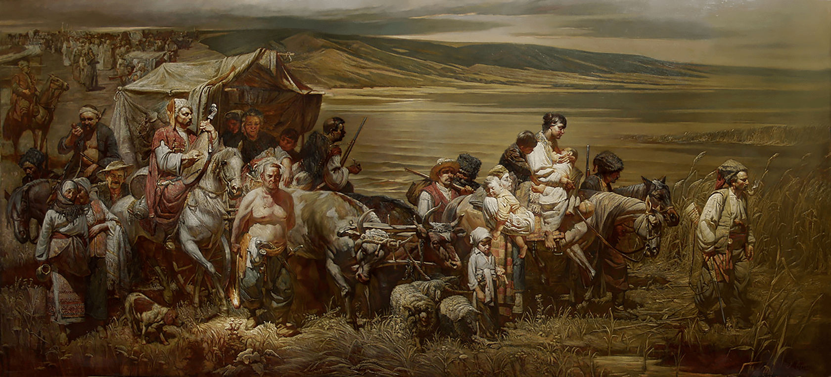
G. T. Kvashura. Zaporozhian Cossacks' Migration to Kuban, 2006. Oil on canvas, 300 cm х 700 cm.
After the final conquest in 1828 of the Turkish fortress of Anapa, the former bulwark of Ottoman influence in the Caucasus, the question arose of how to settle Russians on the new territories. In 1832 a decree was issued regarding permission to 'settle all who wish, with the gift of freedom from taxes and duties'.[23] As a result, the fortress and surrounding areas became a centre of attraction for fugitives and settlers: '…several years ago whole villages fled to Anapa because those unfamiliar territories seemed like the promised land, where labour was not hard and thankless, where a person could live easily and freely'.[24] As the Soviet folk utopias researcher Kirill Chistov noted, the active occupation of Zakubanye from the 1860s led to the fact that 'by 1878 there were 112,000 (or 17.8%) residents in the Kuban who were not Cossacks'. The attractiveness of these territories was reinforced by the fact that in 1868 peasants were permitted to purchase land. But of course, real life in the land of 'Anapa' was far from these utopian notions.[25]
[23] V. Novitsky, "Anapa i zakubanskie poseleniia" in Bitvy za Anapu (St Petersburg, 2017), p. 93.
[24] D.L. Mordovtsev, Samozvantsy i ponizovaia vol'nitsa, p. 154. Cited in K.V. Chistov, Russkaia narodnaia utopiia (genezis i funktsii sotsial'no-utopicheskikh legend) (St Petersburg: Dmitry Bulanin, 2003), p. 351.
[25] For details of the difficult life of the settlers, see: V. Novitsky "Anapa I zakubanskie poseleniia" in Bitvy za Anapu (St Petersburg, 2017).
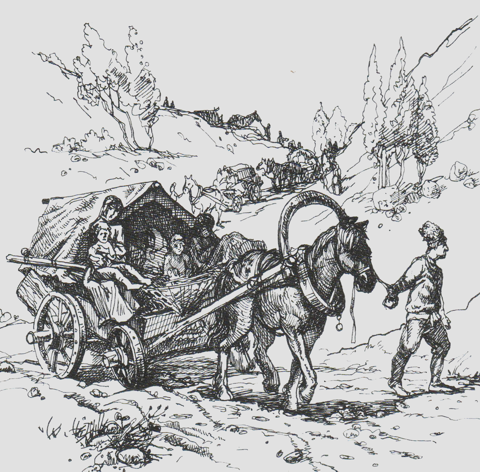
Pavel Bushuev. Migration of Peasants to 'Anapa'. Illustration from The Battle for Anapa, Saint Petersburg, 2017.
Conflict gradually developed between Cossacks and non-Cossacks, plus the traditional Cossack community, for which the existence of the shared land of the military kosh, or camp was of principal importance, was in decline. The concept of kosh (from the proto-Turkic göč — to roam/migrate) means the Cossack community and its organs of power, which are situated on a particular territory. For example, Zakhary Chepega founded Yekaterinodar (Krasnodar) as a military kosh for the Black Sea Cossacks. That is, the political structure and the distribution of land were based on the community principle, and the community was inseparable from the shared military territory. It either chose the land itself or received it in exchange for military duties, as occurred with Phanagoria Island. In any case, the sense of autonomy and relative 'freedom' on the land of the military kosh was an important part of Cossack identity. It is no accident that the lands of the Zaporozhian Cossack Sich were called 'liberties'. For that reason, the Black Sea Cossacks (from 1860 the Kuban Cossacks) perceived the lands they had been granted as an integral, relatively autonomous region — their kosh 'island', their Black Sea country. Taras Shevchenko writes of his friend, the appointed Black Sea ataman and 'first Kuban writer'[26] Yakov Kukharenko: 'I am sorry that I cannot now visit him in his free Black Sea country' (diary entry for 1 July 1857). And the writer Nikolai Kanivetsky named his main book From the Bygone Black Sea Country (Yekaterinodar, 1900).
[26] This expression is from the site of the Kuban Literary Museum, located in the home of Y. G. Kukharenko in Krasnodar. Available via the link
The Cossack intelligentsia's idea of the underlying social structure contradicted reality. The proportion of non-Cossacks (incomers) who leased and bought land from the Cossacks was growing. And Cossack society began to split along class lines. The Kuban politician and writer Fedor Shcherbina believed that the collapse of the community was due to the practice of allocating land to the Cossack leadership. This took place alongside the policy of attracting people from other cities and the merger in 1860 of the Black Sea Cossacks with the Caucasus Line Cossack Host, as a result of which the Black Sea/Little Russians were diluted by Great Russians. All of these measures led to the weakening of autonomy and the washing away of the Black Sea 'island'.
In this situation, patriotic Cossack intellectuals tried to restore community ideals, but in new conditions. Fedor Shcherbina attempted to unite the idea of the golden age of the Cossack community with works by more modern mid-19th-century ideologues of cooperation. Influenced by Chernyshevsky and also by Eduard Pfeiffer and Ernst Bechers' works on associations (workers' cooperatives), in 1869, together with co-thinkers from the Caucasus Religious Seminary, he created an agricultural association in the Cossack village of Brinkovskaya. The comrades wished to demonstrate the advantages of collective over individual labour for nothing less than the radical transformation of their local area and then Russia as a whole. After 2.5 years, the young people disbanded the association, but for Shcherbina interest in forms of community remained central. In 1917–1920, the Kuban Regional Government, of which he was a prominent ideologue, tried to implement the idea of people's rule by the Cossacks, conceived as a combination of Cossack patriotism and popular socialism. During the Civil War, the regional government attempted to preserve Cossack autonomy and its geocultural island. Fearing that the largely pro-Bolshevik incomers might unite with the Cossack poor, they were compelled to form an alliance with the monarchist forces of Denikin, which resulted in their destruction.
In this situation, patriotic Cossack intellectuals tried to restore community ideals, but in new conditions. Fedor Shcherbina attempted to unite the idea of the golden age of the Cossack community with works by more modern mid-19th-century ideologues of cooperation. Influenced by Chernyshevsky and also by Eduard Pfeiffer and Ernst Bechers' works on associations (workers' cooperatives), in 1869, together with co-thinkers from the Caucasus Religious Seminary, he created an agricultural association in the Cossack village of Brinkovskaya. The comrades wished to demonstrate the advantages of collective over individual labour for nothing less than the radical transformation of their local area and then Russia as a whole. After 2.5 years, the young people disbanded the association, but for Shcherbina interest in forms of community remained central. In 1917–1920, the Kuban Regional Government, of which he was a prominent ideologue, tried to implement the idea of people's rule by the Cossacks, conceived as a combination of Cossack patriotism and popular socialism. During the Civil War, the regional government attempted to preserve Cossack autonomy and its geocultural island. Fearing that the largely pro-Bolshevik incomers might unite with the Cossack poor, they were compelled to form an alliance with the monarchist forces of Denikin, which resulted in their destruction.
The Krinitsa Community
At the end of the 19th century, utopianist ideas were implemented on the frontiers of the Kuban and Zakubanye, mainly in the form of communes. In the coastal village of Krinitsa, near Gelendzhik, an eponymous intellectual community existed from 1886. The founders were the Kogans, Viktor Eropkin and Zot Sychugov. The Kogans had met through a radical youth circle that gathered in the home of the composer Serov in St Petersburg in 1869–1870. Military doctor and anarchist Iosif Kogan attracted many people with his ideas of communal self-improvement, including Smolny graduate and 'nihilist' Natalya Drutskaya-Sokolinskaya, the daughter of a Smolensk noble. She became his wife. Together they dreamed of 'building an enormous commune across the world and making everyone happy'.[27]
[27] Chetvert' veka Krinitsy. Izdanie kooperativnogo zhurnala "Nashe delo", Kiev, 1913, p. 8.
The first attempt to organise such a commune on the Drutsky-Sokolinsky estate in Smolensk governorate was unsuccessful. Then the Kogans moved to Moscow, where they met Viktor Eropkin, a noble allied to the Narodnik movement, and Zot Sychugov, the son of a village priest and former exile. Having attempted to organise communes in Ufa and Poltava governorates, they ended up on the Black Sea coast of the Caucasus, 'where the administration, in the interests of settling the periphery, did not really interfere in the internal life of our group'.[28] In 1884, Zot Sychugov went to search for a suitable place and wrote in his diary: 'Do I need much to be happy? A little parcel of land on which I, in union with pleasant people, can educate and rear the young generation on the ideas of absolute honour and human dignity'.[29] Zot found land on the coast, which Eropkin purchased. They called this place Krinitsa (from the Old Russian for spring or source), and Eropkin supported it financially for the rest of his life.
The main idea of the community was freedom and personal self-improvement, and physical labour was considered an integral part of the religious and ethical issues associated with accomplishing practical morality. Lev Tolstoy was keenly interested in the community, and allegedly wished to visit Krinitsa when he fled his home in 1910, toward the end of his life. In the same year, the first public monument to the writer was raised in Krinitsa. Regardless of the many difficulties, intergenerational conflict and the fact that, after the death of Eropkin in 1909, the community was forced to reorganise as a cooperative artel, the commune survived until Soviet times, after which it was incorporated in a collective farm: a direct continuity of forms of community life.
The main idea of the community was freedom and personal self-improvement, and physical labour was considered an integral part of the religious and ethical issues associated with accomplishing practical morality. Lev Tolstoy was keenly interested in the community, and allegedly wished to visit Krinitsa when he fled his home in 1910, toward the end of his life. In the same year, the first public monument to the writer was raised in Krinitsa. Regardless of the many difficulties, intergenerational conflict and the fact that, after the death of Eropkin in 1909, the community was forced to reorganise as a cooperative artel, the commune survived until Soviet times, after which it was incorporated in a collective farm: a direct continuity of forms of community life.
[28] Ibid., p. 23.
[29] Ibid.
[29] Ibid.
Nevertheless, the experience of Krinitsa was perceived in various ways. Here, in 1898, Vladimir Korolenko heard in the sound of the sea what was 'almost a threat from eternal and mysterious nature: you will all disappear without trace and I will make noise and dash against the coastal cliffs in view of new madmen and adventurers'.[30] Tenyears later, having seen the crisis in the colony, he expressed himself more directly: 'the original idea appealed… to its opposite… heaven on earth cannot be established in a cell or a monastery or a separate community: "the New Jerusalem"… should include the whole of humanity'.[31]
The possibility of turning a utopia into its opposite, a dystopia, is the leitmotif of island imagination. Plato's Atlantis degradedbecause it was isolated from the rest of the world.[32]
Another example is Mikhail Shchetinin's school. His Lyceum and Boarding School for the Complex Formation of the Personality of Children and Teenagers operated near Krinitsa, in the village of Tekos, from 1994 to 2019. The school's aim was 'to resurrect Rus with the domestic way of life' and pupils simultaneously followed the programme and gathered the harvest on the school farm. The school was particularly popular among followers of a new religious movement, the Ringing Cedars of Russia, with outside observers evaluating the project in very different ways. Some considered it a sect and others an important pedagogical experiment. In 2017–2019, Krasnodar artist Alina Desyatnichenko visited the now-closed school. The result was the project School Diary, which is a sharp reflection of the complexity and contradictions of social island imagination.[33]
[30] V.G. Korolenko, diary entry 6 July 1898. At this time, Korolenko was a guest of his friend, F. A. Shcherbina in neighbouring Dzhankhot, where he would soon build a dacha for himself. Subsequently, in 1904, Korolenko and Shcherbina visited Krinitsa again, together. I am grateful to the Krasnodar local historian Andrei Stupachenko for directing me to Kirintsa and Shcherbina's commune in Brinkovskaya.
[31] A note regarding G.A. Vasilevsky's book Intelligentskaia zemledel'cheskaia obshchina Krinitsa: K istorii iskaniia obshchestvennykh form ideal'noi zhizni published in the 'New Books' section of the journal Russkoe bogatstvo, 12, 1908, pp. 167–169.
[32] Like Atlantis, the Black Sea Coast Defensive Line (1834–1854) quickly turned into an isolated dystopia. As A.A. Bestuzhev-Marlinsky, who was sent to the Caucasus as a soldier and died in 1837 in a skirmish with local mountain people near the fort of the Holy Spirit (now Adler), wrote: 'All year round you couldn't even stick your nose outside, as the Circassians even beat the guards on the rampart' (Otechestvennye zapiski, 1860, vol. 7). An almost year-round blockade, attacks, illness, hunger, boredom and drunkenness were all factors in the high death rate among soldiers, which led to the liquidation of the of the line in 1855. The defences unwittingly became isolated 'islands': in fact, it was planned that they would expand and transform the surrounding area. For more detail, see: E. Vasiliev, "Chernomorskaya beregovaya liniia 1834–1855" in Bitvy za Anapu (St Petersburg, 2017), pp. 106–127.
[33] Information about the project is available on the artist's site.
Technopeasants
Today, the utopian imagination is implemented mostly in the field of art. 'Living classics' of Kuban painting Aleksei Parshkov and Vladimir Migachev work at opposite poles of island imagination, with utopia–dystopia. Parshkov demonstrates the possibility of earthly utopia. In his multicoloured and compositionally balanced paintings he constructs his own Kuban myth, his version of the harmonious existence of Man on Earth, and in real life he cultivates land adjoining a manor house and is creating a rock garden in a village near Krasnodar. Migachev employs a limited palette, with an aesthetic reminiscent of Scandinavian noir, and uses existential-expressive gestures which look like drips of black paint to depict abandoned, devastated, empty, torn and disturbed landscapes.
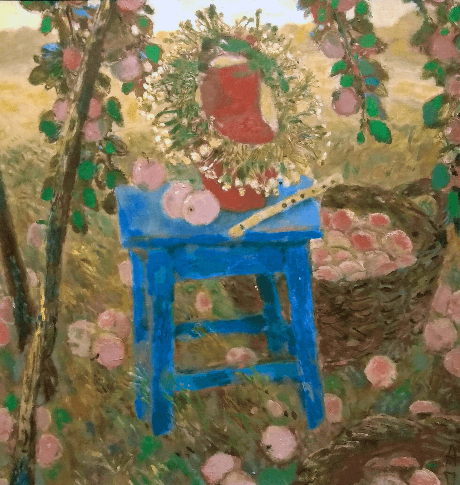
Aleksei Parshkov. Still Life with Flute, 1993-1995. Oil on canvas, 110 cm х 100 cm.
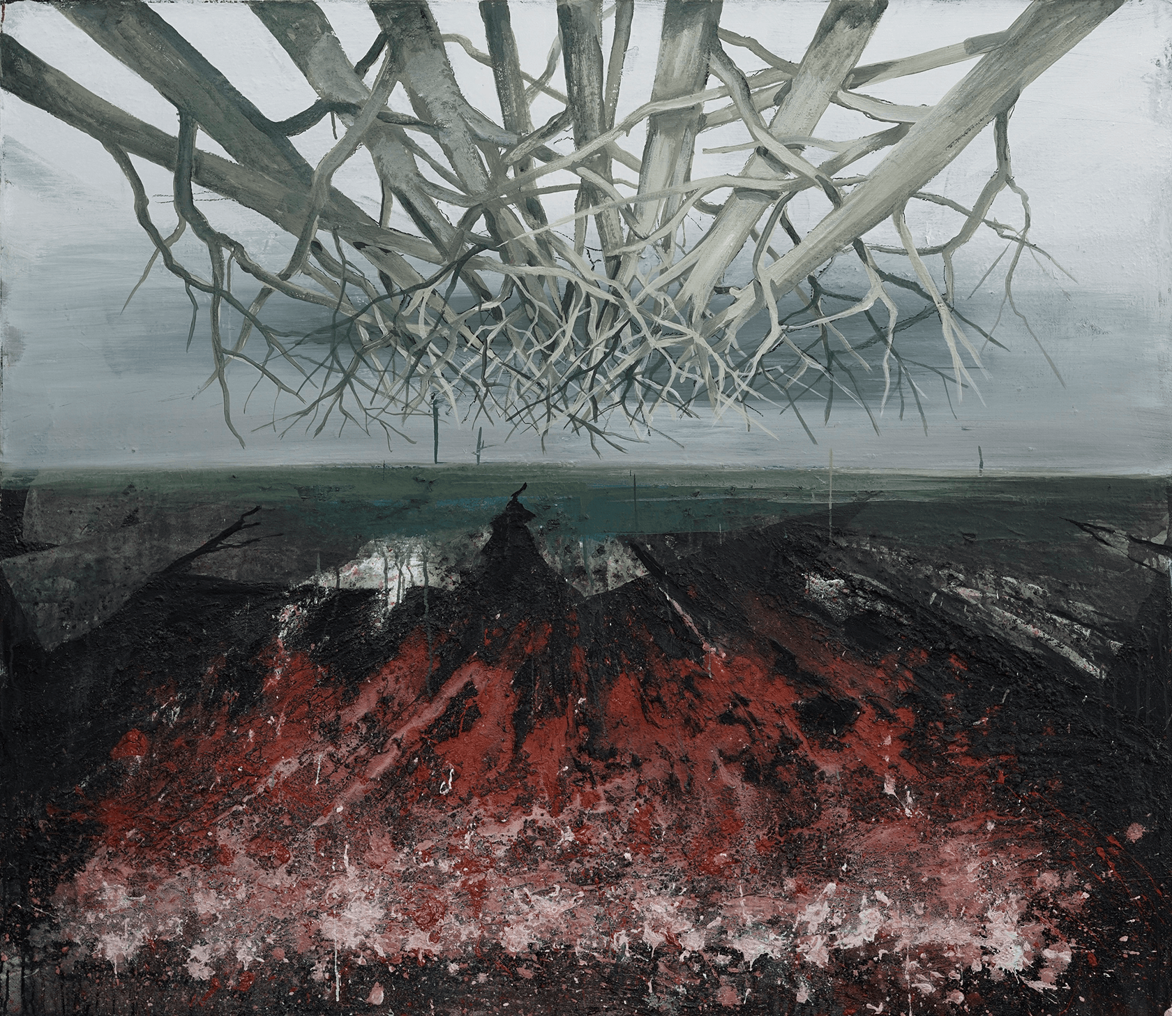
Vladimir Migachev. Krai (Region), 2019. Mixed media on canvas, 130 cm х 150 cm. Courtesy of the ARTSTORY Gallery.
Utopia is transformed into its opposite gradually; it is a constant dialectical process. Settlers' finding of a new homeland (geo-utopia) is accompanied by the loss of the old one (geo-dystopia), which is why the visual codes of these genres are so similar. At some point Alexander Chechin's utopian Disembarkation of the Black Sea Cossacks at Tamagne (1955) turns into the anti-utopia of the painting series Tamagne Campaign by Yuri Skorikov (1957–1994). In turn, his student Gennady Kvashura, with The Resettlement of the Zaporozhye Cossacks in the Kuban (2006), fixes an interim moment of this movement, reminding us that the result of the journey is never clear to the migrant.
Many people connected utopian hopes with settling in the frontier and Black Sea areas of the Kuban and with life on the southern coast. These dreams were reflected in local art. In painting of the second half of the 20th century they are expressed in the blooming gardens of the 'Kuban Bonnard', Mikhail Arkhangelsky or through the 'Gauginesque notes' in the work of Svetlana Kurmaz. In the late 1980s and 1990s, a whole galaxy of postmodernist artists appeared, including Nikolai Vataman, Vladimir Palchenkov and Vadim Abramov, who embodied in their art oneiric (dream-like) mythological worlds, reckoning nevertheless on the utopia of the post-Soviet art market.
At around this time numerous creative groups began to appear in the coastal areas. They attempted to conceptualise their artistic 'islands' on alternative foundations.
One of the first was the Zaumland of Anna Tarshis (Ry Nikonova) and Sergei Sigei. These avant-garde artists, transfuturists and zaum practitioners lived in Yeysk from the 1970s to the 1990s. In their work they saw the town as Maeotis or Zaumland and they stamped their works 'Zaumland'. This conceptual space has the same relationship to real territory as the space of language has to objective reality, developing according to its own rules.
From 1987 to 1995 the summer camp Mosquito Mange took place on Tuzla Island. It was visited by sci-fi and fantasy lovers from more than 20 cities across the Soviet Union and later the CIS. The camp was neighbours with the Bosporus Forum for Contemporary Culture, which was working on the geopoetics of the Mediterranean and the Cimmerian Bosporus (the Kerch Strait). In Sochi in the 1990s, there was a group of artists, poets and musicians known as the Guild of the Beautiful. Their collective actions were aimed at creating nomadic loci [34] of art: the transformation of everyday spaces and the creation of situational associations. For example, in the action High Art (1997) they turned a passenger plane flying the Sochi–Moscow route into an art object. And during the action Trip to Tuapse (1998), they did the same thing to a carriage in a train travelling from Sochi.
[34] In other words, moving, nomadic spaces that temporarily turn into places where art 'happens'. One might say that the reorganisation of the space is, in this case, art.
However, the real 'geniuses loci' in terms of island imagination are the Krasnodar artists ZIP group. Since 2010, the group has run an art residency in the village of Pyatikhatki, suggesting guests combine leisure and communication with artistic practices, and in this way inspiring them to create temporary artistic associations (communities). In 2020 a new stage began: Pyatikhatki became a place of activity for a commune of technopeasants. This project explores the peculiarities of geo-utopian imagination in the region, in particular the experience of agricultural communes in the early USSR. The starting point is the history of the Khutorok estate near Armavir, where in the early 1920s there was a commune of the proletarian poor or, as ZIP call them, technopeasants. Later, a collective farm appeared in that place, but where did the commune go? The answer may be the key to all of early Soviet history. In its attempt to establish the fate of the technopeasants, ZIP suggests two versions: the Kuban Chevengur either went underground or up into the sky, together with its inhabitants, like the flying island of Laputa in Hayao Miyazaki's animated film. By intertwining the geopolitics of the island with the theme of utopia and linking it to agriculture and communes, the artists demonstrate to us the structure of island imagination as a whole and the geo-utopian imagination of the entire region.
To a large extent, what has been said about Tamagne and its island imagination can be applied to all of the Kuban, as indicated by the popular saying: 'If heaven on earth exists, it's in Krasnodar Krai'. The artist Vladimir Migachev, in a private conversation with the author of this text, noted that even today many of the inhabitants of the region, when travelling to Voronezh or Moscow, say 'I'm off to Russia'. In the same way, residents of isolated regions of the far north say 'I'm off to the mainland'. In this case, the geo-utopian or island imagination works due to the frontier factor. But on Tamagne, peripheral geocultural isolation overlays real physical and geographical insularity (a long existence as an island or quasi-island). This is why the geopoetics of the island, with all of its utopian and eschatological overtones, remains key to understanding the region and its geographical imagination.